The 10 basic cloud types — and what they predict.
Almost every cloud you’ll ever see falls into one of ten types, sorted by how high they sit. The higher and wispier they are, the farther out the weather they’re telling you about.
High clouds
20,000–40,000 ft
Made of ice crystals. Generally signal early changes in the weather pattern.
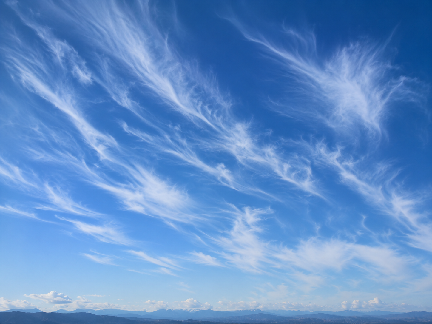
Cirrus
20,000–40,000 ft
Delicate, feathery wisps streaked across a high blue sky.
- What it usually means
- Usually fair right now, but often the first sign weather is shifting.
- Quick signal
- If wisps thicken and spread within 24 hours, expect rain or snow inside a day or two.
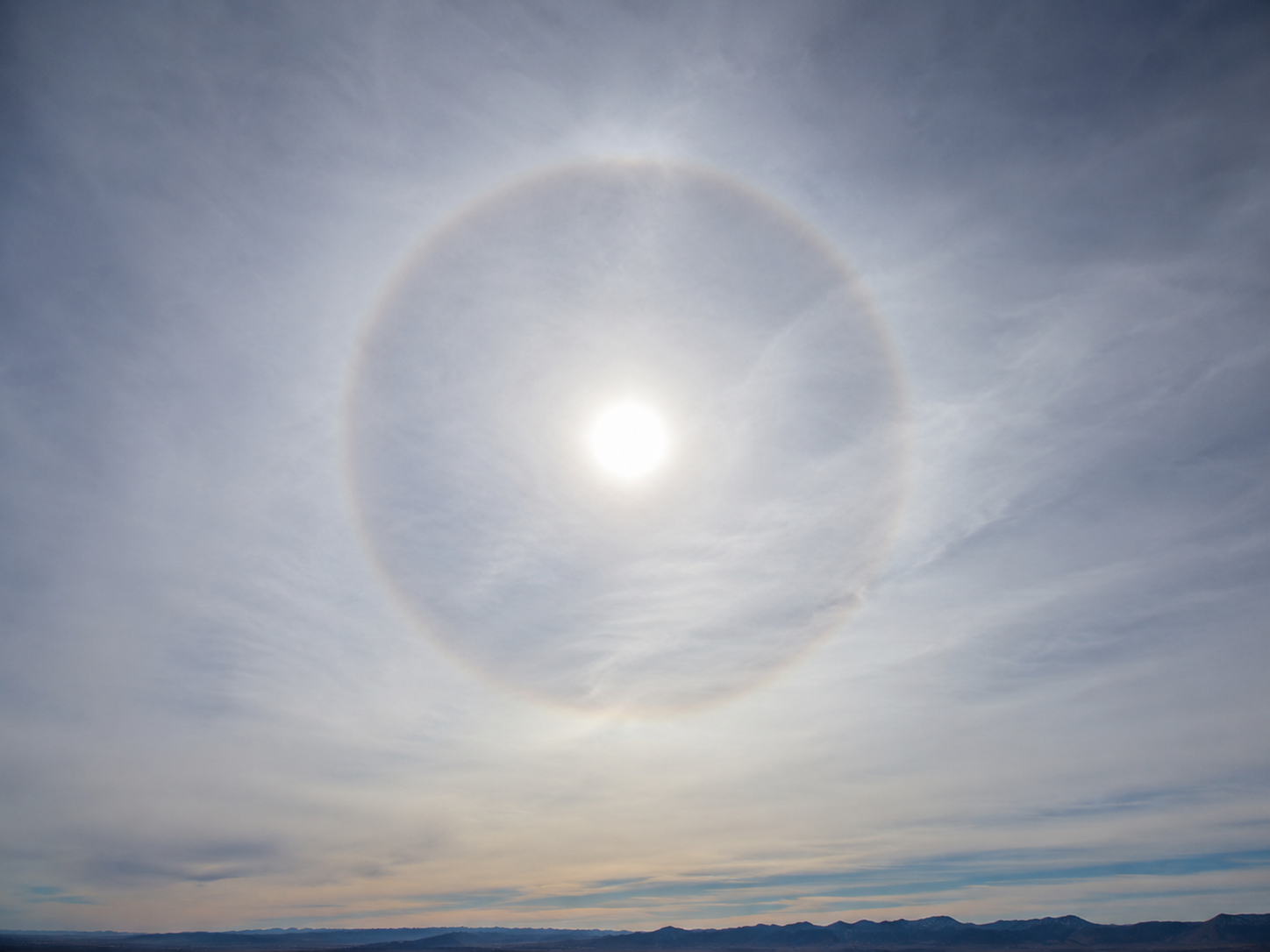
Cirrostratus
20,000–40,000 ft
A thin, milky veil across the entire sky. Often produces a halo around the sun or moon.
- What it usually means
- Approaching warm front. Rain or snow within 12–24 hours is very likely.
- Quick signal
- See a halo around the sun or moon? Expect precipitation by tomorrow.
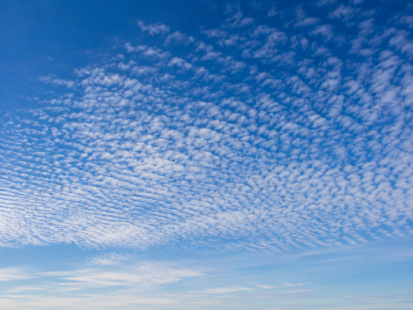
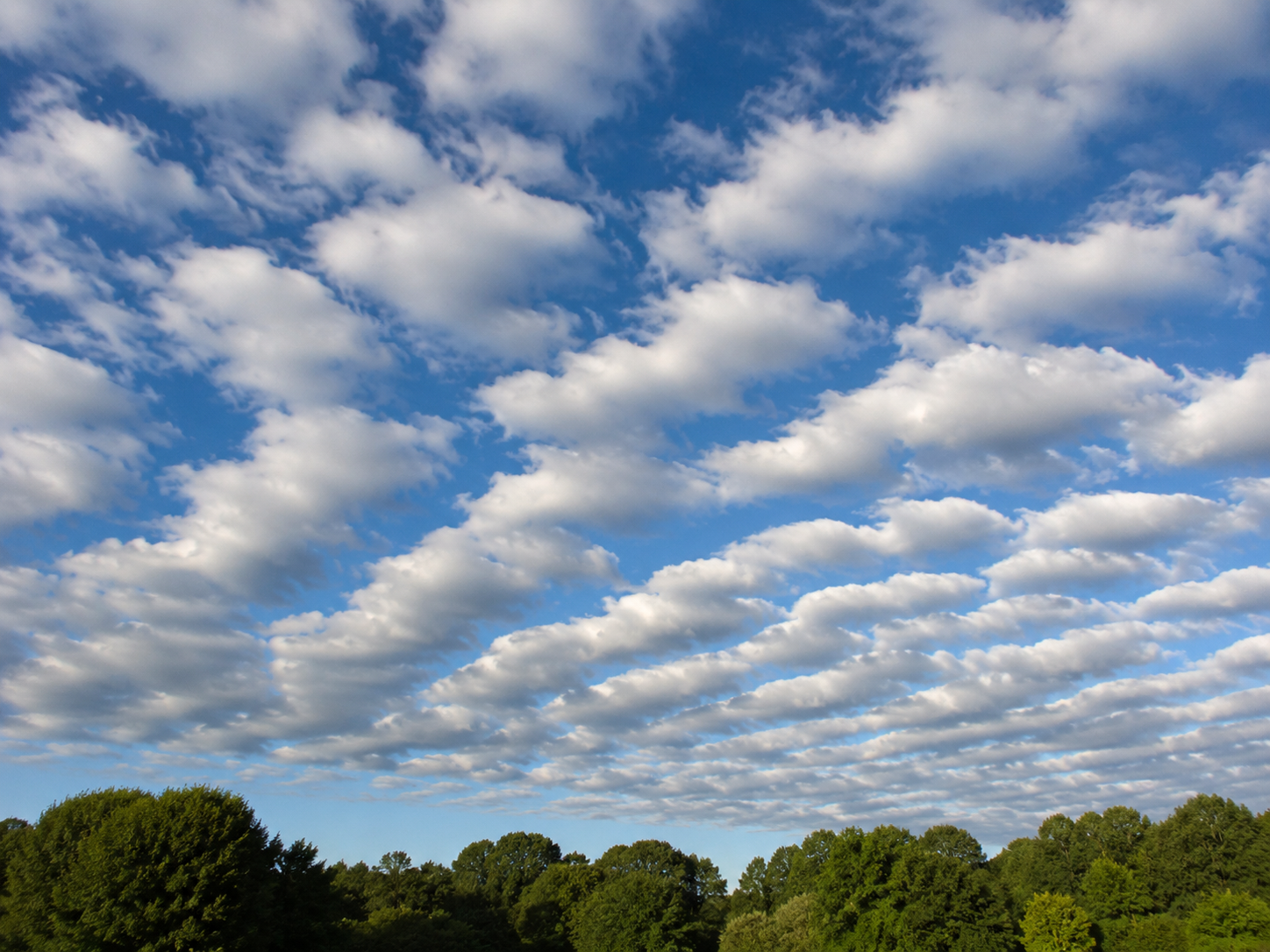
Cirrocumulus
20,000–40,000 ft
Tiny white tufts arranged in rows or ripples — sometimes called a "mackerel sky".
- What it usually means
- Generally fair right now, but unsettled weather may be approaching.
- Quick signal
- Mackerel sky: traditionally a sign of changeable weather within the next day.
Middle clouds
6,500–20,000 ft
Mostly water droplets, sometimes mixed with ice. Often precede or follow active weather.
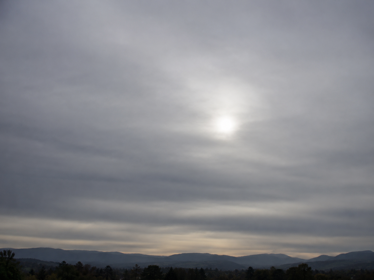
Altostratus
6,500–20,000 ft
A gray or blue-gray sheet that turns the sun into a dim, watery disc.
- What it usually means
- A warm front is moving in. Continuous light rain or snow often follows.
- Quick signal
- Sun looks like a frosted bulb? Steady, all-day rain is probably on the way.
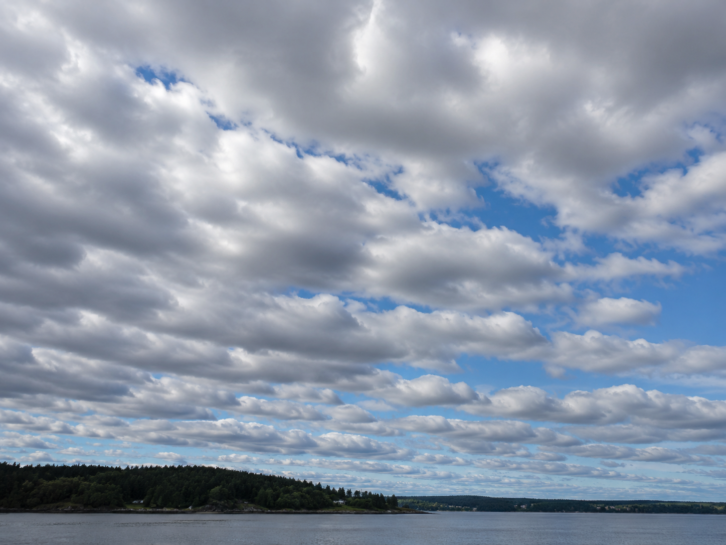
Altocumulus
6,500–20,000 ft
Patchy white or gray puffs in rows, with bits of blue showing between them.
- What it usually means
- Generally fair, but on a warm humid morning they can preview afternoon thunderstorms.
- Quick signal
- These on a sticky summer morning? Watch for thunderstorms by mid-afternoon.
Low clouds
Below 6,500 ft
Almost entirely water. The clouds you can clearly see structure in.
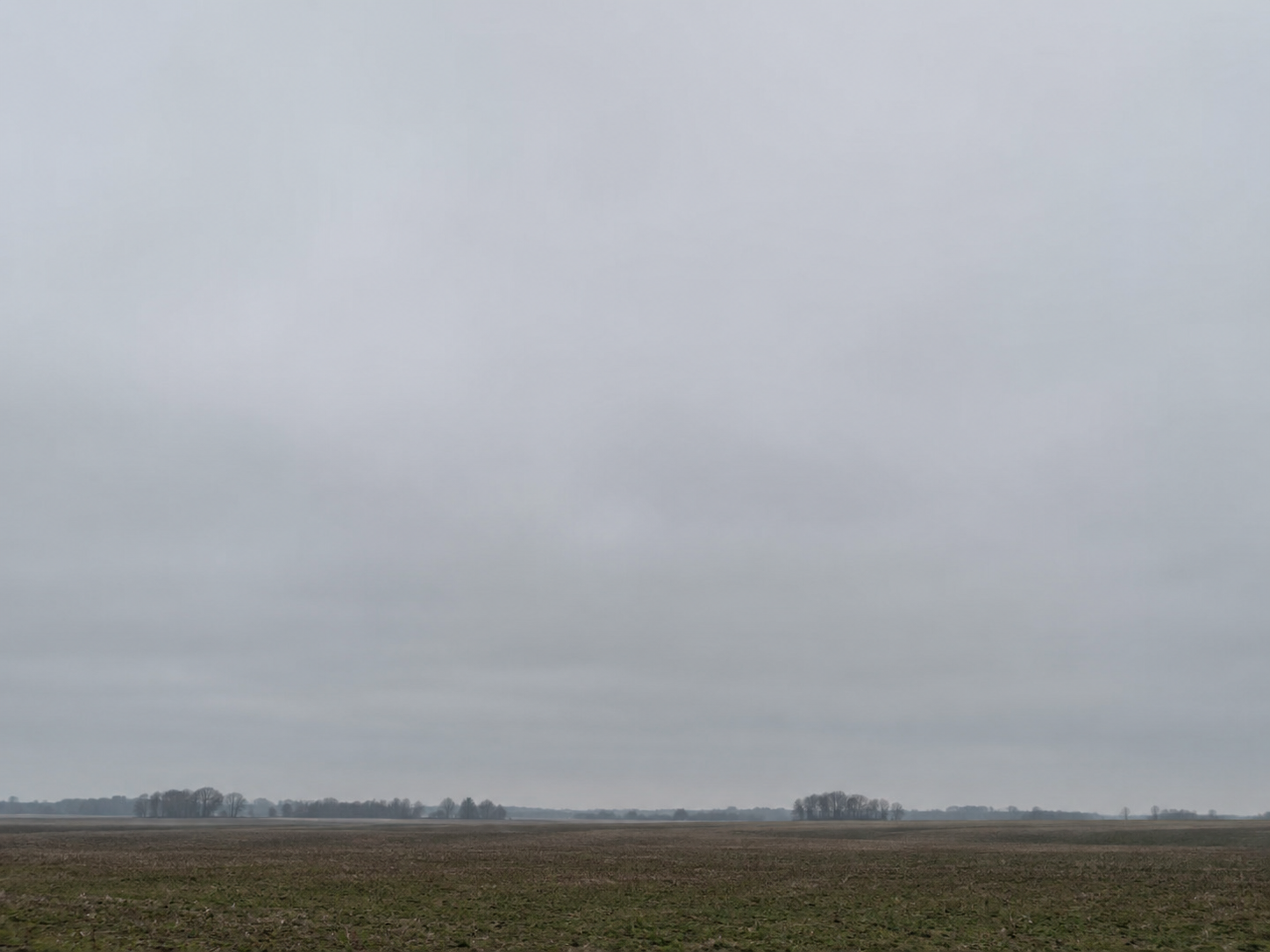
Stratus
Below 6,500 ft
A flat, featureless gray blanket sitting low — basically fog you can stand under.
- What it usually means
- Drizzle or light mist possible. Mostly just gloomy and gray.
- Quick signal
- Settles in for hours. Don't expect dramatic weather, but pack a light layer.
Stratocumulus
Below 6,500 ft
A lumpy, low blanket of cloud broken into rolls or patches.
- What it usually means
- Usually fair. Occasionally light showers, but often clears by evening.
- Quick signal
- Most common cloud on Earth. The sky is having a quiet day.
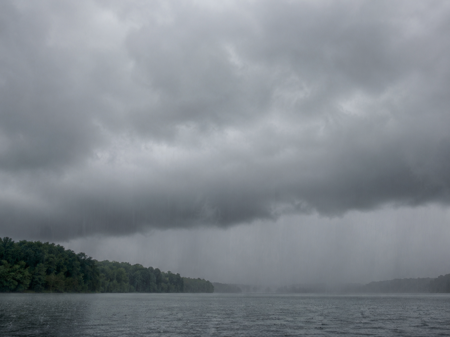
Nimbostratus
Below 10,000 ft (often thick)
Thick, dark, shapeless gray that blots out the sun and seems to fade into the falling rain.
- What it usually means
- Steady rain or snow, often for hours. The cloud you see during a "rainy day".
- Quick signal
- Already raining or about to. No clearing for a while.
Vertical clouds
Variable, can stack thousands of feet
Built by rising air. Range from fair-weather puffs to towering thunderheads.
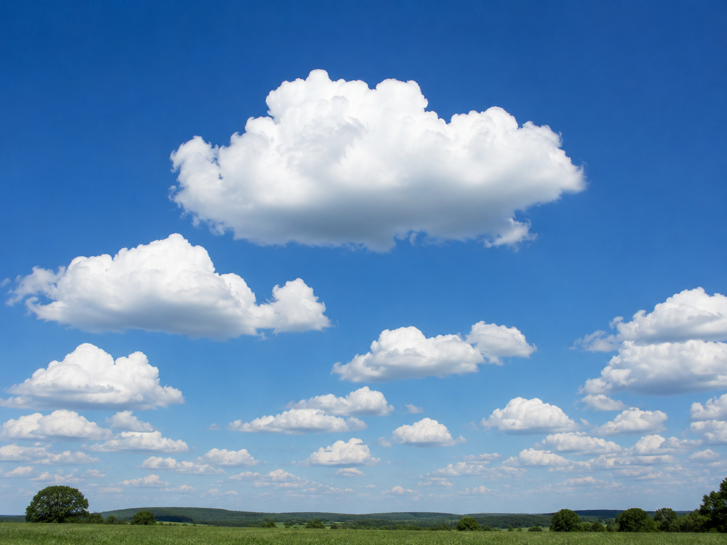
Cumulus
Base ~3,000 ft, can tower higher
Bright white, fluffy "cotton ball" clouds with crisp edges and flat bases.
- What it usually means
- The cloud of fair weather. Rarely brings more than a brief shower.
- Quick signal
- Small and well-separated: stay out, enjoy the day. If they start growing tall and crowded, watch them.
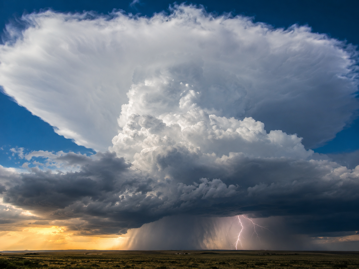
Cumulonimbus
Base low, can tower above 50,000 ft
A massive, anvil-topped tower with a dark base. The "thunderhead".
- What it usually means
- Thunderstorms, lightning, heavy rain, hail, sometimes tornadoes.
- Quick signal
- See an anvil top spreading flat? Take shelter. Severe weather is here or imminent.